
A Chicago Salad vs A Chicago Melting Pot, 2019
ink and graphite on digital drawing mounted on black illustration board
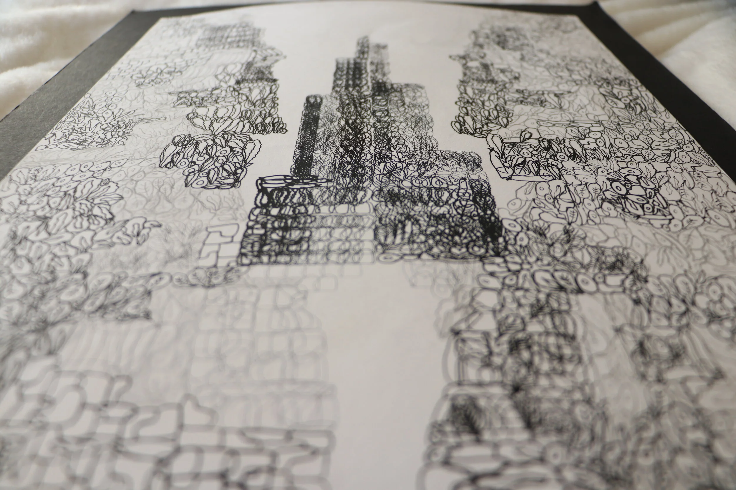
The idea for this project was to create a landscape that had evolved between past and present or present and future. Naturally, I chose to depict Chicago, my hometown, through its distinct topographic organization - it being on the border of a lake. One of Chicago’s defining characteristics is that, despite its diversity and cultural richness, it remains extremely segregated*. A map was the ideal way to represent this separation. Since we were limited to using only marks to create the composition - no lines were allowed - I employed the metaphor of the “Salad Bowl” and the “Melting Pot” and chose food items to translate my point. Both these terms are expressions used in the context of Geography to describe the spatial organization and societal makeup of a city. The former refers to a city that is diverse, but remains heterogeneous - like a salad, there is a variety of "ingredients" - or in the case of a city, a variety of cultures and nationalities - but they remain separated. The latter refers to a city that is both diverse and homogeneous - like in a melting pot, all the ingredients meld together to form a cohesive whole. In my piece, the left side of the map and tower represent the "Salad Bowl": all the districts and neighborhoods are composed of only one single salad element, either lettuce, avocado, radishes, peas, spinach, or croutons. The right side of the map - which is reflected to create a symmetrical composition - refers to the idea of the "Melting Pot": the same districts and neighborhoods are drawn with the marks mixed together and layered over one another. This landscape thus portrays Chicago's present and Chicago's potential future. It is, in short, my vision for how I wish Chicago to be: united in diversity.
I used different lines weights in order to create dimension and contrast because I realized the marks quickly lost their definition when thy were the same thickness. The tower portion of the piece was added later in the process, when I had thought to abandon the idea of creating a map, but then decided to merge the two together. Of course, the tower not only references the Sears Tower specifically, but also the architecture that Chicago is known for. The placement of the tower in the middle also helps fill the void created by the map - where Lake Michigan is located on a real map - while anchoring the piece within its specific space and context. Only those who know the map of Chicago and who know the city could understand the specific reference I make, but nonetheless, I felt that the unique organization of the city together with the intricate marks creates an intriguing and appealing composition.


*I do not dive deeper into the topic of Chicago’s segregated nature, for it is very complex, but it is a very important phenomenon to study. History teaches us that its roots lie in the practice of redlining which consists in the refusal to give loans to people who live in areas that have been “red-lined”, in other words, demarcated as poor financial risks. This severely limits low-income and minority communities from acquiring houses, thus entrenching racism into spatial organization.